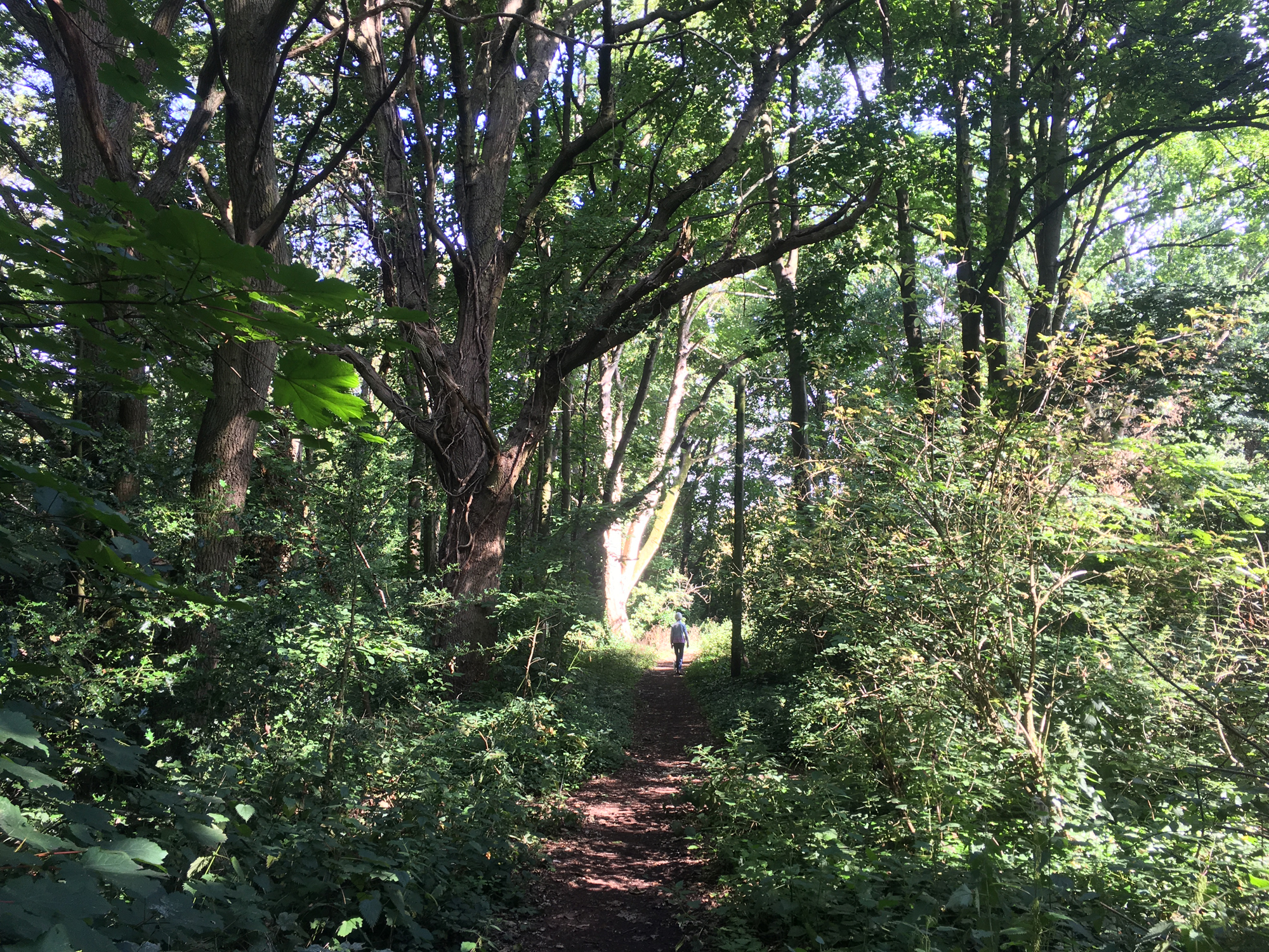
There are several suggested walks connecting with Bernards Heath, including the St Albans Green Ring.
Bernards Heath – showing boundaries and the location of the Ariston site.
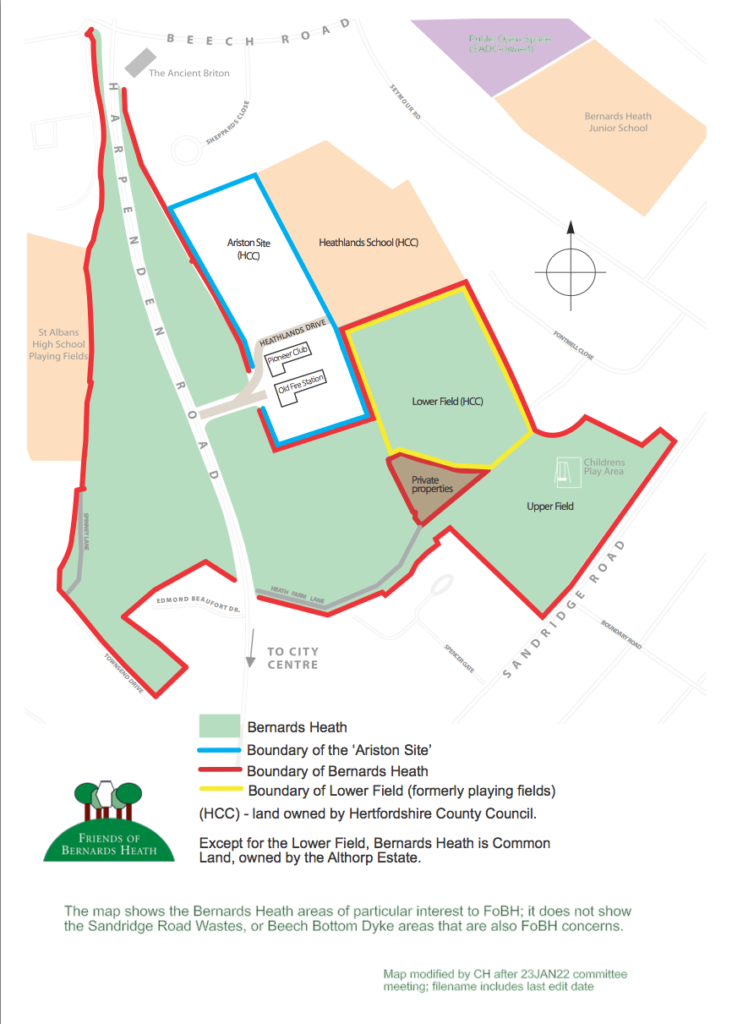
A link to a site map from Herts County Council can be found here.
Hare Map 1634
The image below shows the northeast part of the Hare map of 1634 – the oldest to show a fragment of Bernards Heath, shaded in pale green. At that time it was called Barnett Heath with the town gallows pictured on the top right corner of the map. The map also shows that Barnett Heath was outside the boundary of the borough of St Albans (heavy black line).
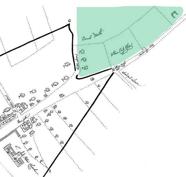
The latter boundary is now in a different position.
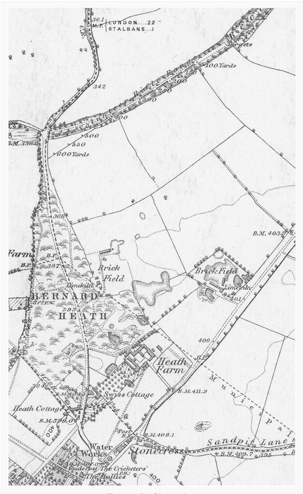
1883 Ordnance Survey map
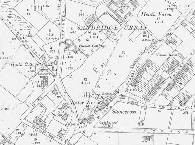
1898 Ordnance Survey map 1
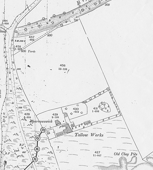
1898 Ordnance Survey map 2
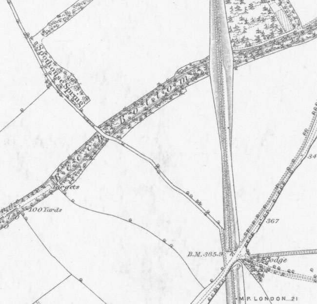
The Heath in detail and sections around the Ancient Briton junction and the Stonecross area are shown below:
1843 Tithe map
A vector redrawn part of the 1843 Sandridge Parish Tithe map showing properties adjacent to Bernard Heath (sic).The original map is held at the HALS library in Hertford.
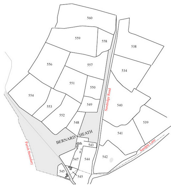
Tithe Apportionments* for the map above
| T | A* | R | P | £ | s | d | ||||
| 534 | Earl Spencer | Robert Smith | Hither Upper Jennings | A | 11 | 1 | 35 | 13 | 5 | |
| 539 | .. | .. | Sandpit Field | A | 10 | 3 | 9 | 17 | 8 | |
| 540 | .. | .. | Seven and Eight Acres | A | 17 | 1 | 2 | 1 | 0 | 6 |
| 541 | .. | .. | GallowsField | A | 12 | 1 | 24 | 16 | 6 | |
| 542 | .. | .. | Cutbert Mead | G | 9 | 0 | 2 | 13 | 5 | |
| 543 | .. | .. | Close Adjoining Windmill Farm | G | 3 | 0 | 27 | 10 | 3 | |
| 544 | .. | .. | A Close | G | 1 | 3 | 23 | 6 | 1 | |
| 545 | John Oakes | owner | Waterworks House and garden | – | 2 | 7 | 2 | 0 | ||
| 546 | George Alfred Muskett | Robert Weetley | House and garden | – | 1 | 1 | 22 | |||
| 547 | Earl Spencer | Robert Smith | Farmhouse buildings garden and orchard | – | 4 | 1 | 22 | 7 | 0 | |
| 548 | Thomas Burningham | Widow Brown | Harvey Close | G | 3 | 0 | 0 | 4 | 4 | |
| 549 | Charles Forman Gape | John Field | Little Meadow on Bernard Heath | G | 2 | 3 | 29 | |||
| 550 | Thomas Burningham | Widow Brown | Four Acres | A | 4 | 2 | 25 | |||
| 551 | .. | .. | Ten Acres | A | 9 | 1 | 21 | |||
| 552 | .. | .. | Brick Close | A | 3 | 1 | 33 | |||
| 554 | .. | .. | Twelve Acres | A | 13 | 0 | 5 | |||
| 556 | .. | .. | Twelve Acres | A | 13 | 1 | 23 | |||
| 557 | .. | .. | Nine Acres | A | 10 | 1 | 23 | |||
| 558 | .. | .. | Dead Womans Hill | A | 3 | 3 | 35 | |||
| 560 | Earl Spencer | Robert Smith | Bottom Close and Ten Acres | A | 15 | 0 | 7 | 17 | 5 |
*Areas are in acres, rods and perches, A, R, P, where 1 acre = 4 rods = 160 perches and 1 acre = 4840 square yards. Column T denotes type of land, A = arable, G = grass.
Not all payments to the vicar are listed.
2010 OS Explorer map of St Albans and Hatfield at a 1:25,00 scale shows Bernards Heath, but not in much detail.