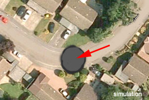
The dramatic impact of a collapse 66 feet across on the residents of Fontmell and Bridle Close is beginning to emerge. Many have suffered loss of essential services and arrangements for emergency services have been made.
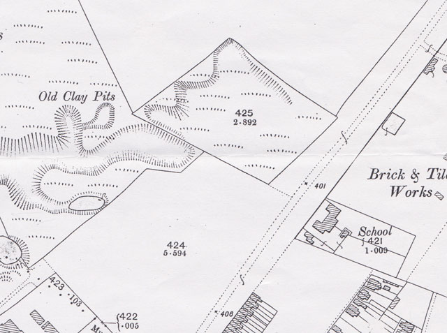
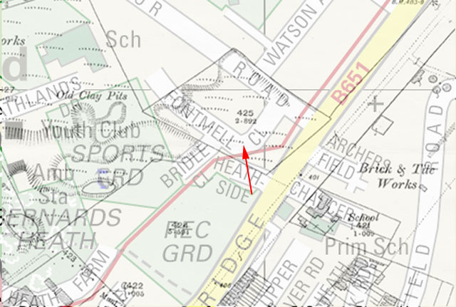
While it has been known for some time that this area of what was Bernards Heath was prone to collapse, the size of hole is unprecedented. An overlay of the 1898 OS map in this area places old clay pits very close to Fontmell Close, see below, and could well be a contributary cause.
Hertfordshire County Council is arranging for some non-intrusive ground investigation works in the area, commencing this weekend (3rd October): they will be on site for about a week. The company concerned is Geotechnology limited, and will be taking access to the site from Heathlands Drive. We await the findings with interest.