Following the emergence of a depression or ‘hole’ not far from the centre of the Lower Field in late November 2019, Hertfordshire County Council commissioned a geophysical survey of the Field by GBG Geotechnics, Cambridge. A lengthy quite technical report on the survey was made available to FoBH and here we try to summarise its findings.
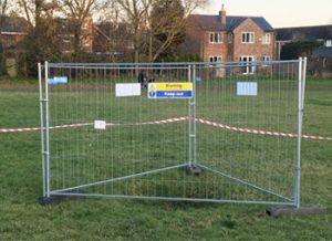
The hole was promptly surrounded by safety fencing and soon after by more fencing. The appearance of yet more fenced off areas last year led to some concern whether the whole field would be excluded to the public. We have no indication that this might be the case.
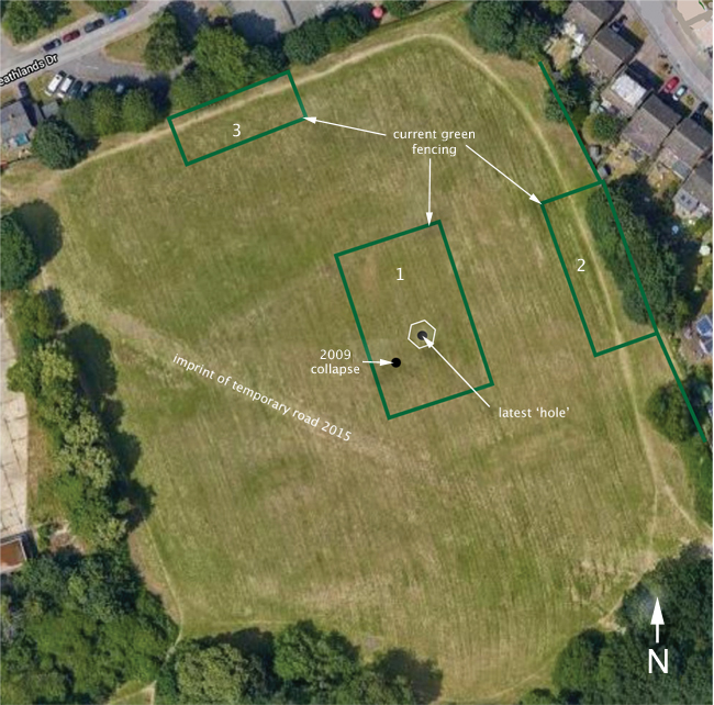
Much of the field, particularly the southern end (bottom of the image below), has been subject to workings for the extraction of clay for brick making. Kilns for this purpose were also known to be located here. OS maps from 1878, 1898, 1924 and 1939 showed the extent of the workings. In 1965 these workings were less extensive, presumably following infilling by rubbish and soil as available. The smell of the rubbish dumped in the field is well remembered1.
In 2015, following the appearance of a large sinkhole in Fontmell Close, survey work was carried out before the installation of a temporary road across the field. The imprint remaining from this road is marked on the image below.
Survey Findings
The field survey was carried out using three techniques: Impulse radar, Ground conductivity and Microgravity. The latter is capable of the most accurate measurements of variations in ground density. The force of gravity was measured over a 30 x 30 m grid at 2m intervals around the present hole, but not over the whole field. The report contains Google aerial photos with contours superimposed to represent the variation of measurements by the above three techniques.
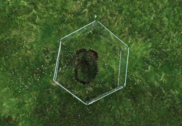
When physically measured at the time of the survey the surface hole opening was 3.2m in diameter by 0.94m in depth.
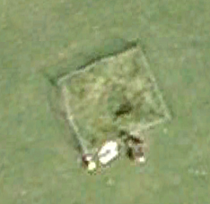
In image 1, the hole is close to a previous collapse of the ground in 2009 (photo below). This appears to have been backfilled and no further action taken.
A circular feature measuring c.27-23m in diameter has been identified around the hole from the Impulse Radar. In all there were five subsurface features around the hole, interpreted as disturbed ground, voiding or slight changes in ground condition.
The hole is coincident with a solution feature (old pit) documented on historical maps.
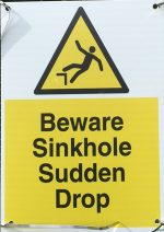
Following the survey, three areas have been fenced off (image 1) and labelled with numerous somewhat alarming warnings.
Area 1 surrounds the site of the collapse. Ground conductivity measurements have revealed two additional anomalies in fenced off areas 2 and 3. Area 2 has an elongated anomaly of irregular shape and just to the west of the path and area 3 is to the north of the survey area which has a small depression. This latter area is coincident with reworking of the ground in 2011.
Away from the current hole, six possible features have been identified, four on the Lower Field and two to the east of the Skate Park.
Google maps show the Lower Field is about 160m by 140m. Using the length of the fencing sections, a simple calculation of the area enclosed by fencing is roughly 9% of the total field area.
1H.R.Wilton Hall, Herts Advertiser, 23rd September, 1905.