Telltale signs
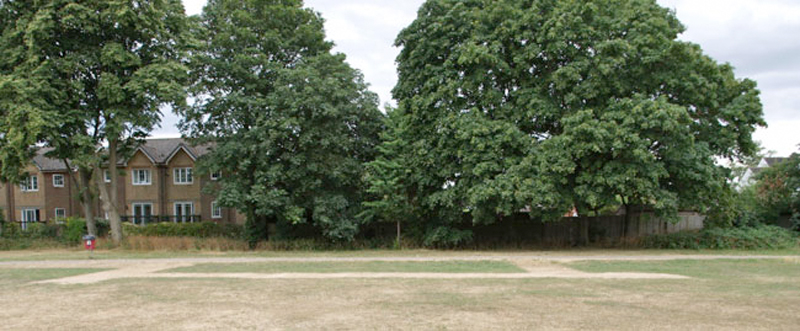
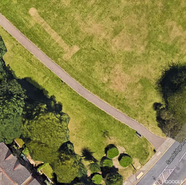
In very dry weather the grass of Verulamium Park shows clear signs of the Roman buildings below the surface. Bernards Heath, not to be outdone, has its own version, but indicating more recent history. The marks in the recent hot spell could not have been clearer (See ground level below and Google aerial photo, the latter taken before the marks had fully developed).
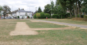
The marks in the recent hot spell could not have been clearer (See ground level below and Google aerial photo, the latter taken before the marks had fully developed).
Archaeologists refer to signs in vegetation growth as cropmarks, or parchmarks when the effect is extreme. If re-filled ditches or pits lie beneath the surface plants will grow better over them and resist drought. The reverse happens when walls or foundations just beneath the surface reduce the amount of topsoil holding moisture.
During the last war both private and public air raid shelters were constructed throughout the country. St Albans was no different and the Heath was the location of one public shelter, in the south corner of the Upper Field, opposite Heath Bakery.
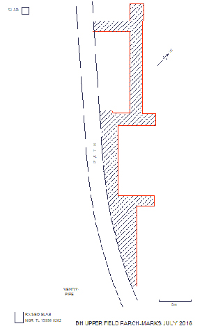
A measured survey of the parchmarks was done recently and the result is shown in the plan. It is clear that not all of the underground structure is showing, only the parts to the right of Boundary footpath. Why is not obvious. The ground to the left is closer to the tall trees at the edge of the field and consequently shaded from the sun. However, the abrupt change across the path suggests some other factor. The Upper Field is common land, not known to have been dug for brick clay and subsequently back-filled, so variations in soil resulting from that can’t be responsible.
When St Albans carnival was a regular event in the past it formed up on the Upper Field. On one occasion a float lorry wheel broke through the buried shelter roof. This would have had to be filled, but it is hard to imagine that the whole area to the left of the path would have been filled as a precaution, unless perhaps there were spoil heaps to hand from the original construction. But why stop at the path?
There are two concrete slabs shown on the plan which mark the entrances. The number is confirmed by local people. In addition there is an earthenware pipe in a raised lump of concrete, said to be for ventilation. If so it is almost certain there would have been others, given the apparent extent of the shelter.
Since the end of the hot spell and after rain had softened the ground up, probing was carried out on and around the marks. The depth of penetration is little different over the whole area – 10 to15cm – but within the parchmarks there is a harder, more abrupt stop of the probe when it meets the roof material.
Construction would have been by ‘cut-and-cover’; digging trenches, lining them, then covering with a blast-proof roof of some type, topped with soil.
Wikipedia has a comprehensive entry for Air raid shelter, with many links.
If, or when, further facts come to light they will be added to what is here.
Roger Miles