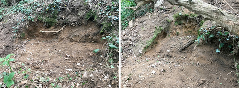
Not the work of badgers, but holes clearly showing spade marks have appeared in the bank about half way along Beech Bottom Dyke. This earthwork was made to form a rifle butt, or safe bank behind shooting targets, about 160 years ago. The digging may well be the work of someone with a metal detector looking for old bullets or other metal objects.
Since the Dyke is a scheduled is a Scheduled Ancient Monument (SAM), where digging or other modifications without authorisation are against the law, anyone caught doing this would face prosecution. Any suspicious activity in this area should be reported to SADC.
Friends of Bernards Heath tries to protect, preserve and enhance the Heath for the benefit of the neighbourhood as a whole, but sometimes it seems that thoughtlessness and downright theft are conspiring against us.
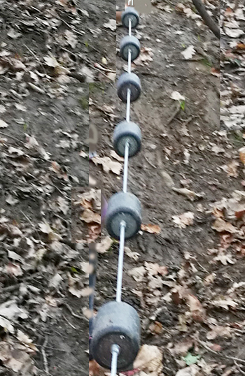
Anyone who has walked along the bottom of Beech Bottom Dyke will be aware that it can be difficult to get over the bank that blocks the Dyke about half way along its length. This is doubly so when conditions are wet.
To try to make this easier, one of our members has designed a system of hand holds attached to a stainless steel wire (see photo). It was securely attached to a tree at the top and provided an easy way to get up the bank. It was however, not long before the wire was stolen. The wire could not be removed without tools and it is clear that someone must have come fully prepared to take it away.
This is very annoying, considering that much time and effort was put into this to help public access. A rope for the same purpose was also stolen.If you have any information about this theft, please contact the chairman via FoBH mail (right sidebar).
Concept and manufacture: RM
Vandalism
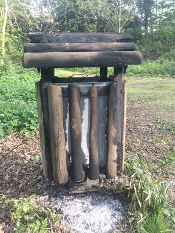
Not content with burning any of the wood lying on the Heath, someone has attempted to burn the wooden cover of an otherwise unsightly metal bin.
Thoughtless vandalism like this detracts from what was otherwise an attractive glade for recreational use.
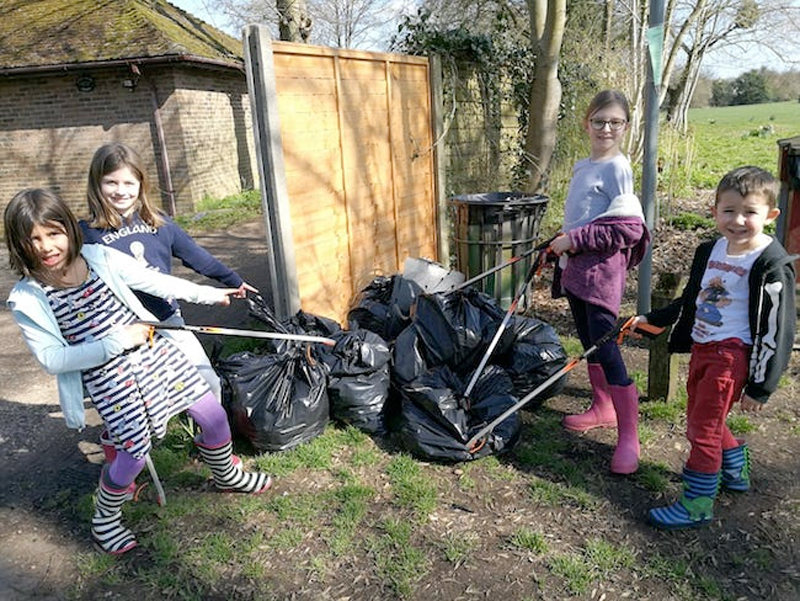
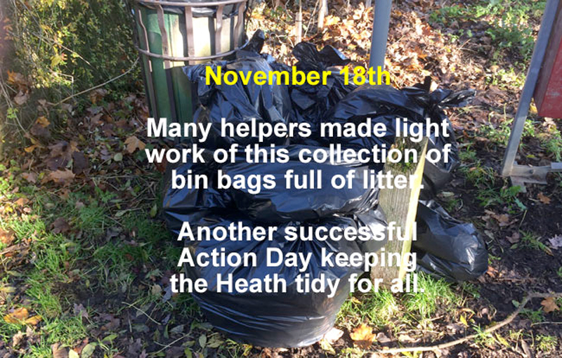
More than 20 people, including these young helpers, turned up for our Action Day on 24th March – maybe it had something to do with the weather which was great. Lots of other bags were placed around the Heath for collection too. Thank you everyone who took part.
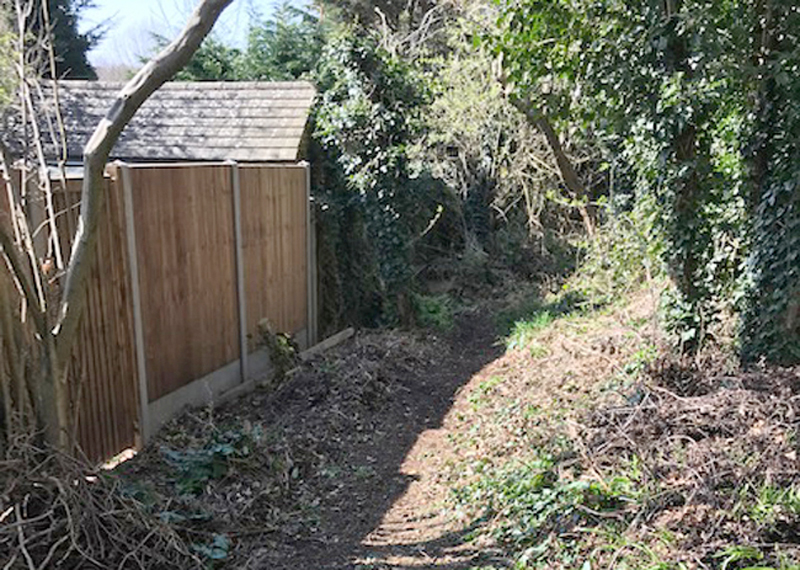
We didn’t forget Beech Bottom Dyke either, where sticks and other wood was blocking this section of the path. Rampant ivy is a also a problem when it results in trees being toppled – we worked on this too.
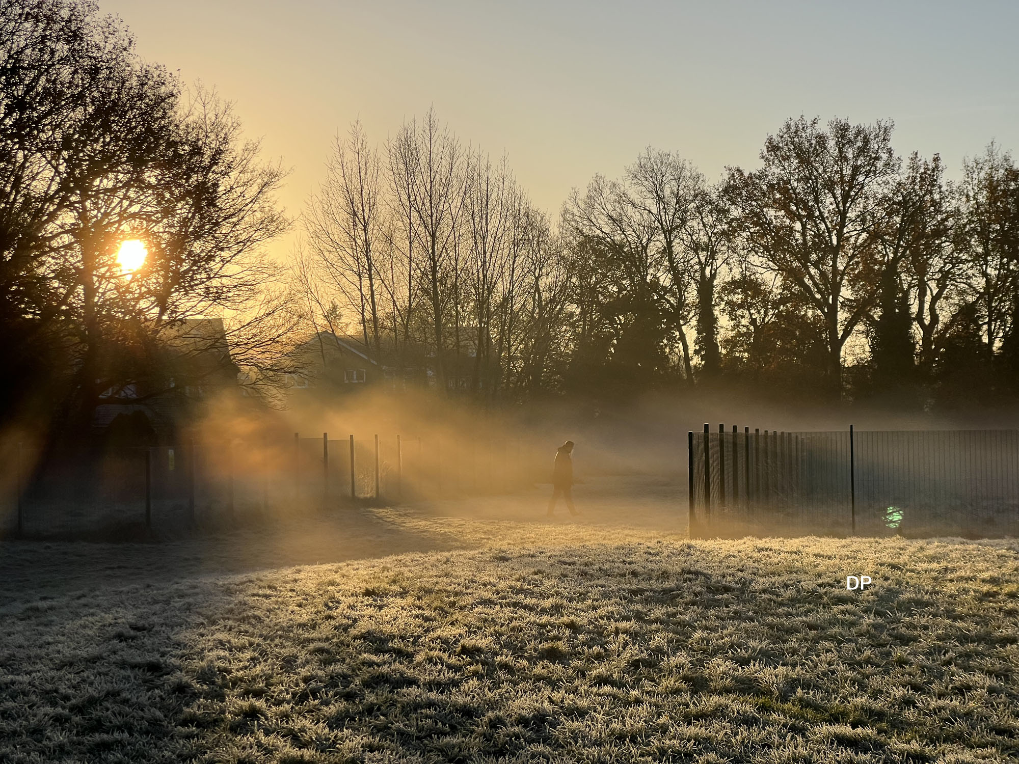
About 2 cm of snow fell over the night 22/23 January and rapidly disappeared. The last substantial fall of snow (for St Albans) was in December 2017.
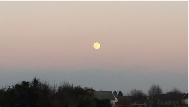
The weather was good enough to see the first phase of the ‘blood red moon’ over the Heath late afternoon on the 20th January. If you were up at 5 am on the 21st, you may have seen a more intense blood red colour.
A Muntjac Deer was found dead by the side of Harpenden Road opposite the entrance to the old Fire Station. Both sides of the road are wooded near this area and probably provide cover for these animals., although one has been spotted running at speed along Waverley Road.
They are 10 – 18 Kg in weight and can do considerable damage in a collision with a car, particularly in this area where speeding is commonplace. Being avid browsers they can also cause a lot of damage in gardens and to trees. If you spot one we would love to have a photo.
A well planned act of wanton destruction took place on the path between Spinney Cottage and Harpenden Road last Thursday or Friday, 23rd/24th August. A fence that was recently repaired was taken apart and sawn up to make a ramp for people on bikes. It is very dangerous.
If you saw any activity in this area, we would like to hear from you (use FoBH Mail in the side bar). Any witness responding will not have their name divulged to anyone other than the police.
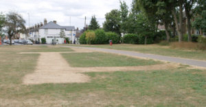
Telltale signs In very dry weather the grass of Verulamium Park shows clear signs of the Roman buildings below the surface. Bernards Heath, not to be outdone, has its own version, but indicating more recent history. The marks in the recent hot spell could not have been clearer (See ground level below and Google aerial photo, the latter taken before the marks had fully developed).
The marks in the recent hot spell could not have been clearer (See ground level below and Google aerial photo, the latter taken before the marks had fully developed).
Archaeologists refer to signs in vegetation growth as cropmarks, or parchmarks when the effect is extreme. If re-filled ditches or pits lie beneath the surface plants will grow better over them and resist drought. The reverse happens when walls or foundations just beneath the surface reduce the amount of topsoil holding moisture.