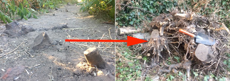
If you’ve walked along the narrow path between the Lower Field and the Heathlands School gate you’ll be aware of several short stumps which were a trip hazard. No more – we have now removed them.
including Beech Bottom Dyke and Sandridge Road Wastes
If you’ve walked along the narrow path between the Lower Field and the Heathlands School gate you’ll be aware of several short stumps which were a trip hazard. No more – we have now removed them.
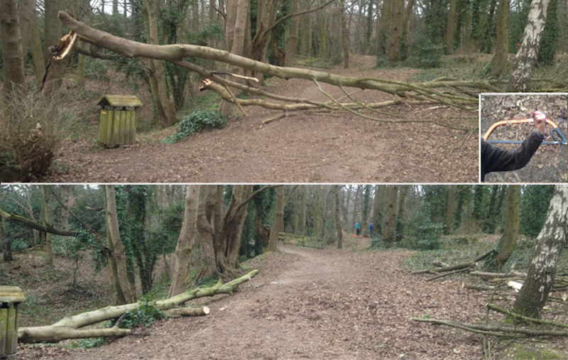
This heavy branch (top photo) )was left across the track from Townsend Drive to the Ancient Briton as the result of Storm Doris. Our chainsaw was faulty, so we were reduced to muscle power and bow saws (inset). As a result this precariously perched branch was moved out of the way. A fallen tree in Harpenden Road caused traffic to be diverted to Townsend Drive/Waverley Road on Saturday afternoon.
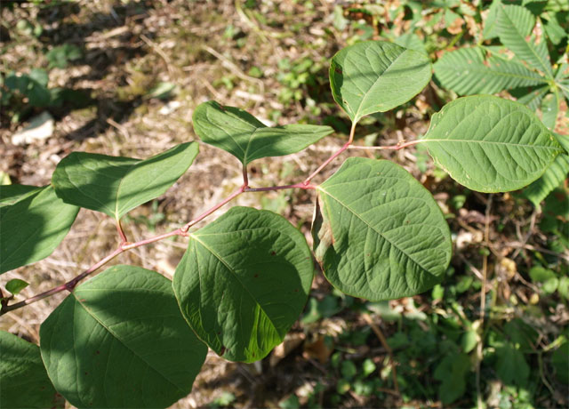
There have been several outbreaks of the not unattractive, but very invasive plant Japanese knotweed on the Heath, mostly near the old Fire Station and behind the Judo Club. It is a major problem in that it grows very rapidly and can cause serious damage, especially to underground structures. A garden outbreak can easily be a reason to refuse a mortgage application.
Continue reading “Japanese Knotweed on the Heath”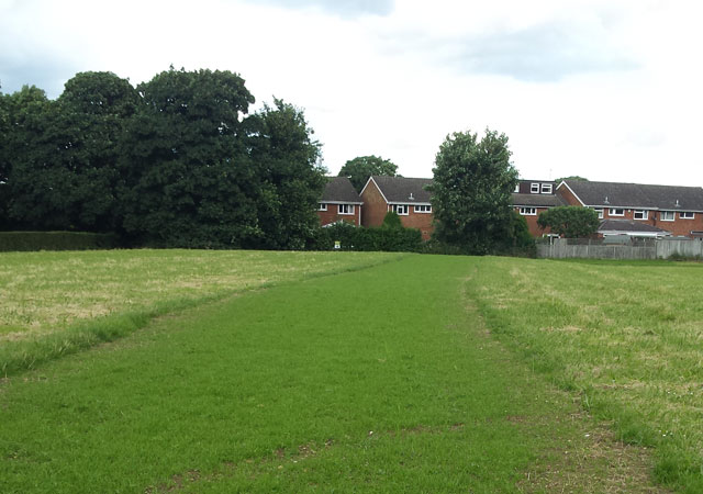
A verdant sward of new grass now runs across the Lower Field towards Fontmell Close. This was recently an unsightly mess following attempts to provide access for residents of Fontmell and Bridle Close after the sinkhole appearance last October. Photo: MN.
Friends of Bernards Heath made a big effort to start clearing paths at Beech Bottom Dyke on Saturday morning. Thank you everyone who took part.
Where, and what is Beech Bottom Dyke? It is a major pre-Roman ancient earth work that begins at the junction of Townsend Drive and Batchwood Drive and runs for the first part parallel to Beech Road, then on across Valley Road to the railway embankment. The Dyke is a Scheduled Ancient Monument (SAM) under the protection of Historic England and owned and managed by St Albans District Council. The Google aerial view below makes the prominent part of the location clear and shows where we carried out path clearance work. Read more about the Dyke here.
Continue reading “Beech Bottom Dyke Action Day 1 – FoBH clears the way”
Work started this week to restore the Lower Field. The photo on the left shows how it looked after the Fontmell/Bridle Close sinkhole episode and the photo on the right shows how things are beginning to look now. Photos: MN Peter Bone, Senior Surveyor – Public Sector Services, Lambert Smith Hampton writes:
I should like to let you know that remediation works to the area of ground that was disturbed by the original temporary access route to Fontmell Close and Bridle Close will be commencing next week. The works will comprise levelling of the rutted areas and cultivating the topsoil ready for grass seeding.
The reinstatement area will need to be temporarily fenced off with cones and tape whilst the works are carried out, and the fencing will be left in place after the area has been seeded to give the new grass a chance to establish itself. The advice we have on that is that it would be best if the reinstated area could be left for the grass to re-establish the root system until May 2017 if possible. It would therefore be helpful if you could help to let users of the field know that a period for the grass cover to regenerate itself will be beneficial in the longer term.
We are also arranging for other works such as grass cutting, weed spraying, and a tidying-up of branches across the larger field area.
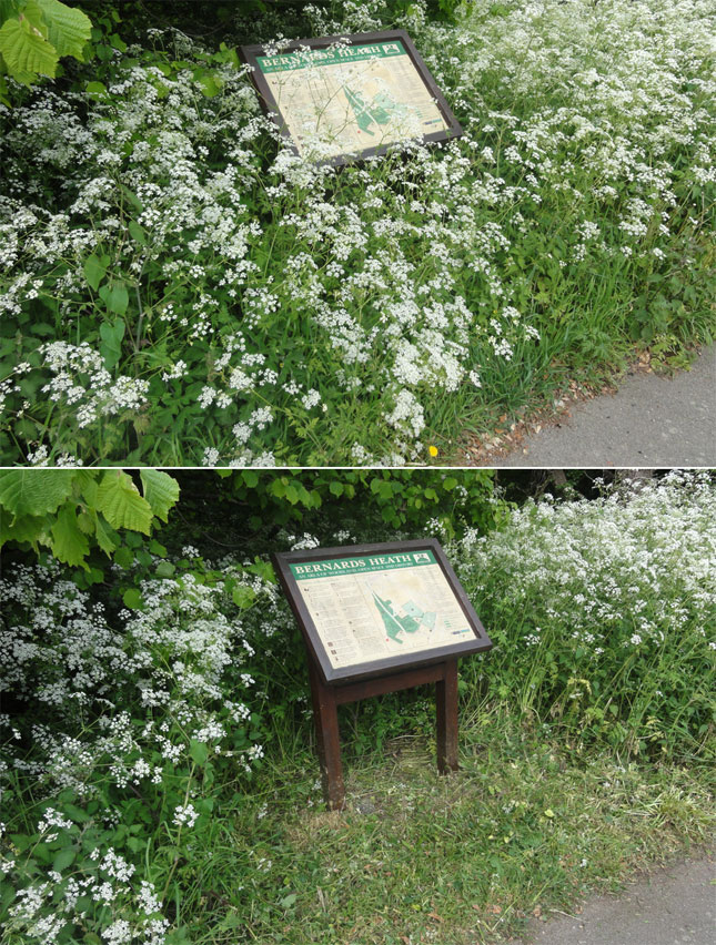
A quick strim of cow parsley has improved access to the interpretation board in Townsend Drive, which provides an excellent succinct history of the Heath. This board and the two others in Harpenden Road and Sandridge Road were installed by the Friends of Bernards Heath. The boards are now beginning to show signs of weathering and replacements are being considered.
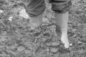
Mud glorious mud – if you’ve walked the paths on the Heath recently you’ll be well aware of this kind of sight where paths become a glutinous, slippery mess.
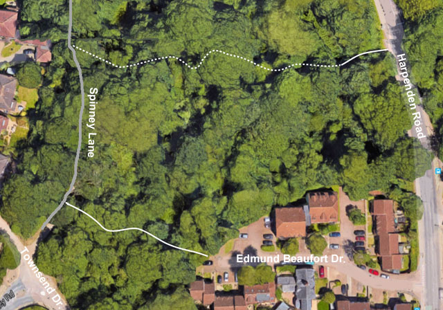
Having recently organised and part funded a new path extension to the Ancient Briton, FoBH has now brought in the same contractor to improve access to the west of Harpenden Road. The aerial view below shows where work has been done, especially between Edmund Beaufort Drive and Spinney Lane. Hopefully, this will make the latter an all-weather path, rather than the mire it was recently. The full extent of paths in this area is not shown.
On this occasion budget restrictions have not allowed St Albans District Council to support us financially even though it was agreed that the need to improve this well used amenity was very great. Therefore, following a resolution at our recent AGM, FoBH has met 100% of the cost from members’ subscriptions.
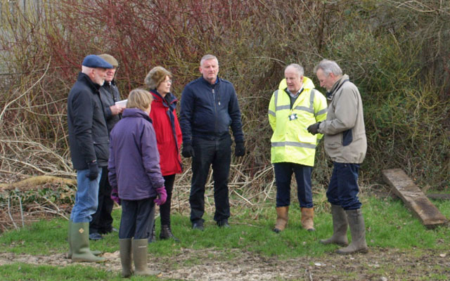
Friends of Bernards Heath met with representatives of St Albans District Council and councillors Roma Mills and Richard Curthoys to review the current condition of the Lower Field. The new road across the field from the old fire station works well, but many objects have been left, seemingly at random, which make the area look untidy and in some areas, dangerous. It is hoped that contractors will be able to tidy up in the near future.
Continue reading “Objects left on the Lower Field”The wooded area of Bernards Heath includes an extensive network of well used paths. As many will know, several of these paths are now very muddy and slippery. They seem to be particularly bad this year, perhaps because rain has fallen with almost daily regularity in December and early January. The paths then have little chance to dry out.
Friends of Bernards Heath has been improving the paths over several years, the cost being shared with St Albans District Council. The longest, a new path extension to the Ancient Briton.
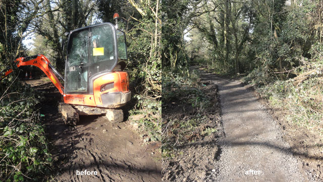
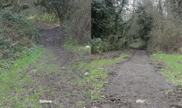
The paths have been dug to a depth of about 4 inches/10 cm and refilled with crushed road scalpings or planings. The resulting surface is much firmer than the muddy areas and drains more easily.
The sections may not always be apparent because of debris falling onto the path, but the image below shows clearly where the path surface is much improved beyond the lower muddy area.
We hope that the Council will continue to support us in our efforts to make the Heath a more enjoyable place to walk.