
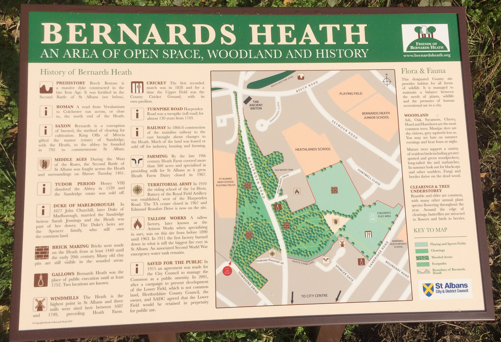
Many people will have noticed that new boards have appeared describing the Heath and Sandridge Road Wastes. The old Bernards Heath boards have been updated and smart new metal frames used instead of wood frames which rotted out. These are formally described as interpretation boards, and they provide a concise account of historical events and industries which once existed on the Heath. Click here for a larger version of the Bernards Heath interpretation boards.
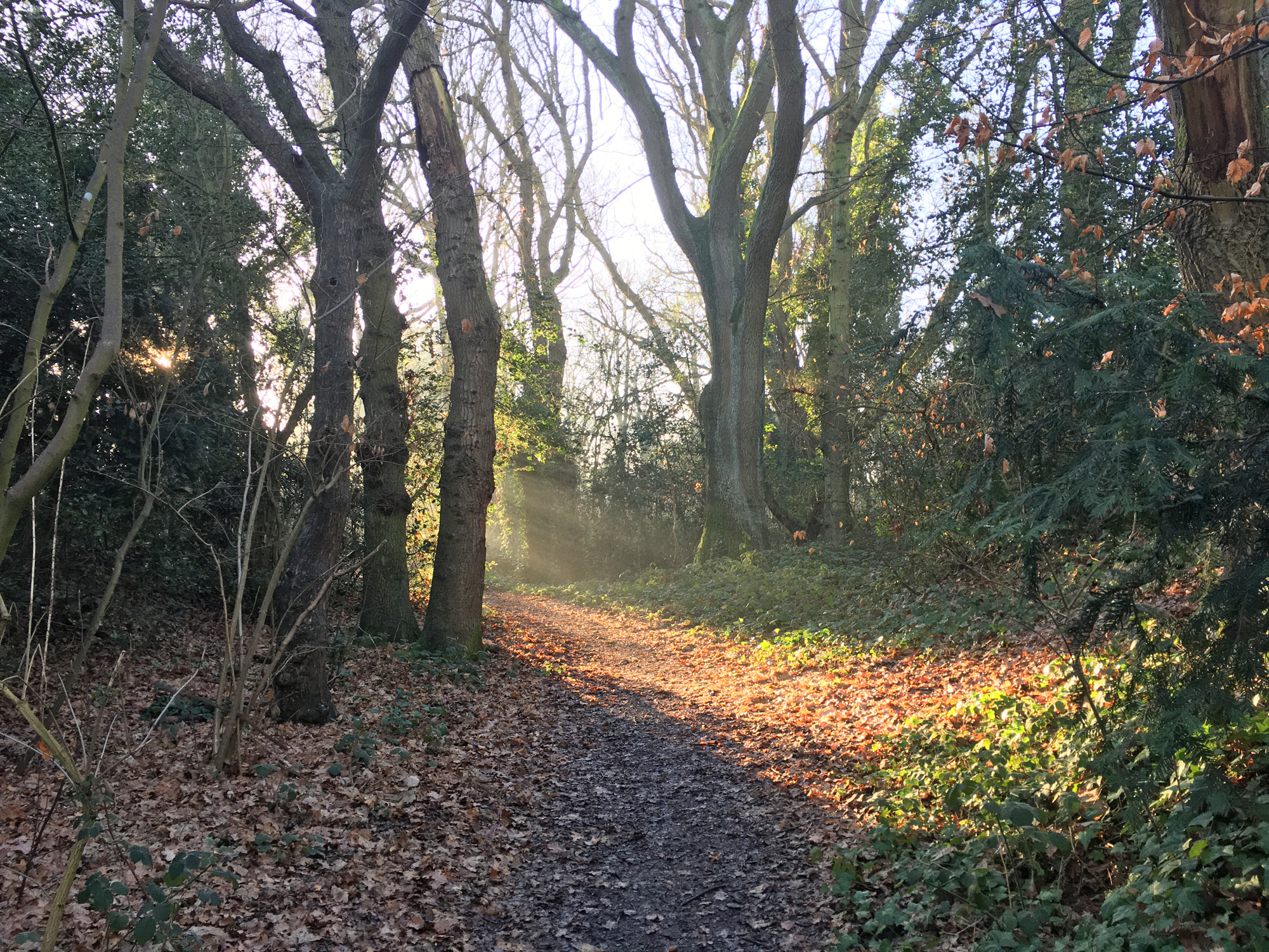
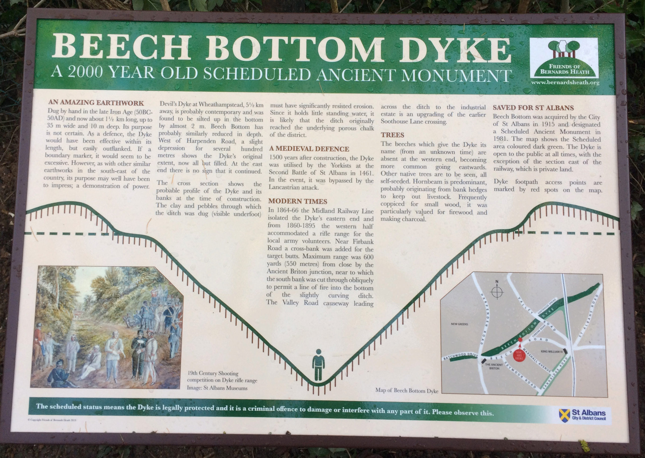
Three boards describe Bernards Heath and three Sandridge Road Wastes (the latter being green areas alongside Sandridge Road). Beech Bottom Dyke is a huge ditch 1 mile long partially hidden behind trees alongside Beech Road and Firbank Road 7 – 10. The map below shows where boards are located.
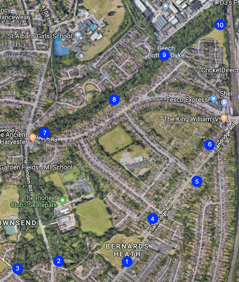
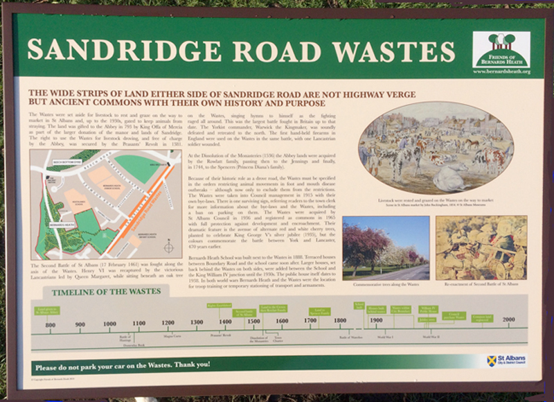
Click here for a larger version of Sandridge Road Wastes. There is a small notice board alongside board 6 which is dated 1955 pointing out that parking is not allowed on the Wastes.
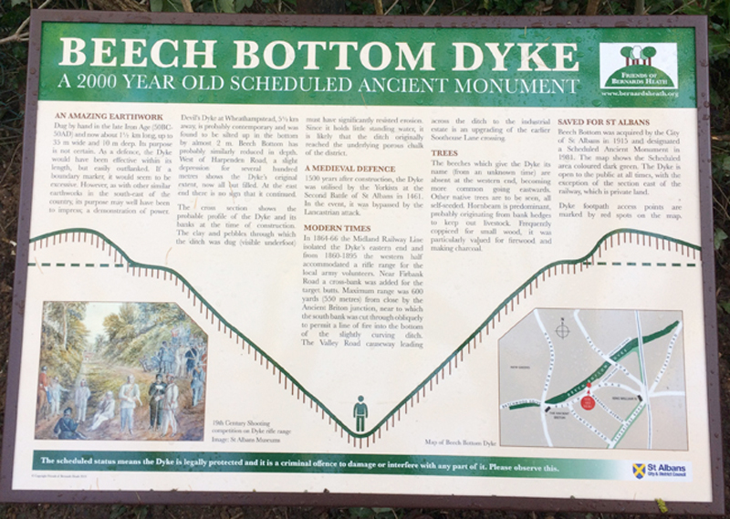
Beech Bottom Dyke has four interpretation boards (7-10). The Friends of Bernards Heath have done much (see here , here and here) to make paths alongside and at the bottom of the ditch more accessible.
Click here for a bigger version of the board.
Many thanks to members of the Friends of Bernards Heath, especially RM and PB for their work on the preparation of artwork and content. The Friends of Bernards Heath paid for the artwork and the St Albans City Council the metal boards and their installation.