A Muntjac Deer was found dead by the side of Harpenden Road opposite the entrance to the old Fire Station. Both sides of the road are wooded near this area and probably provide cover for these animals., although one has been spotted running at speed along Waverley Road.
They are 10 – 18 Kg in weight and can do considerable damage in a collision with a car, particularly in this area where speeding is commonplace. Being avid browsers they can also cause a lot of damage in gardens and to trees. If you spot one we would love to have a photo.
A well planned act of wanton destruction took place on the path between Spinney Cottage and Harpenden Road last Thursday or Friday, 23rd/24th August. A fence that was recently repaired was taken apart and sawn up to make a ramp for people on bikes. It is very dangerous.
If you saw any activity in this area, we would like to hear from you (use FoBH Mail in the side bar). Any witness responding will not have their name divulged to anyone other than the police.
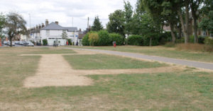
Telltale signs In very dry weather the grass of Verulamium Park shows clear signs of the Roman buildings below the surface. Bernards Heath, not to be outdone, has its own version, but indicating more recent history. The marks in the recent hot spell could not have been clearer (See ground level below and Google aerial photo, the latter taken before the marks had fully developed).
The marks in the recent hot spell could not have been clearer (See ground level below and Google aerial photo, the latter taken before the marks had fully developed).
Archaeologists refer to signs in vegetation growth as cropmarks, or parchmarks when the effect is extreme. If re-filled ditches or pits lie beneath the surface plants will grow better over them and resist drought. The reverse happens when walls or foundations just beneath the surface reduce the amount of topsoil holding moisture.
Beech Bottom Dyke is a striking mile long Iron Age earthwork, linked to Shakespeare’s King Cymbeline, and set in an ancient area of commons called “Bernards Heath”. It is unpublicised and lacks interpretation – except for this guided walk.
This walk forms one of St Albans Heritage Open Days events and will take place on Sunday, 9th September 2018. More details can be found here
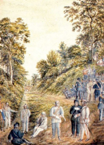
The local 19th century water colourist Henry Buckingham depicted this scene at Beech Bottom Dyke in 1859 when rifle training was given. At that time there was a threat of a possible invasion from France. (by kind permission of St Albans Museum).
The Dyke is St Albans’ least known heritage asset. It is a huge Scheduled Ancient Monument running round the north of the city. Rendezvous at St Saviour’s Church Hall (Sandpit Lane, St Albans, AL1 4DF) at 2.00pm for a short talk followed by a guided circular walk across Bernards Heath, along the Dyke and back to the church hall for refreshments (to be paid for).
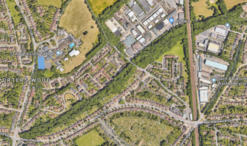
Google aerial view of the Dyke, which follows the diagonal line of trees in the image
We will interpret the setting of the Dyke and explain what is known about it, including its roles in the Wars of the Roses and defending us against the French in the 19th century. Literature and local experts will be on hand on the walk and in the church hall. Free parking is available at or near the church hall. Stout footwear is recommended. Dogs on leads welcome. The Dyke itself is not wheel-chair or buggy accessible. A reasonable level of fitness is needed to walk along the Dyke. The event will end by 5.00pm.
Please note that the the joining instructions below are the right ones and supersede those in the Friends of Bernards Heath newsletter.
Whole event up to three hours, walk approx. one hour.
Numbers are being requested to help the caterers and to ensure we do not exceed the capacity of the hall. Booking will be first come, first served.
Find out more by emailing admin@bernardsheath.org or call 07811 393694
There are no access restrictions for the Church Hall, but the Dyke itself can be rough under foot, especially after wet weather. The barriers there against motor cycles effectively prevent wheelchairs or buggies gaining access to the Dyke.
This sort of event is the only opportunity to enjoy interpretation of this Scheduled Ancient Monument.
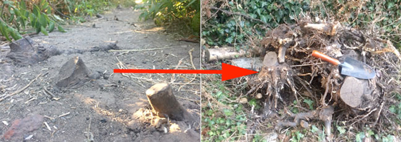
If you’ve walked along the narrow path between the Lower Field and the Heathlands School gate you’ll be aware of several short stumps which were a trip hazard. No more – we have now removed them.
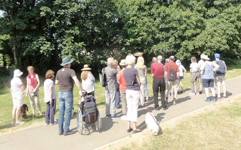
The first Friends of Bernards Heath Tree Walk on Sunday 1st July was led by Roger Miles and as you can see from the photo attracted a group of over 20 people.
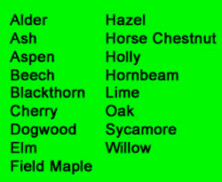
We explored several areas of woodland to the East and West of Harpenden Road finding examples of the trees in the list, (probably not exhaustive). Sadly, there appear to be a few examples of Ash dieback on young trees in the area.
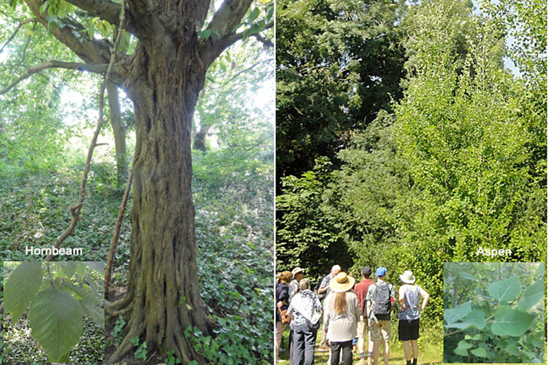
Below are two examples of trees you might like to look out for. On the left there are a few Hornbeams with their characteristic ribbed trunks near Heath Farm Lane (there are many more in Beech Bottom Dyke). On the right, Aspen, the tree with its fluttering leaves, on a path closer to the old Fire Station.
Many thanks to Roger Miles of the Friends of Bernards Heath Committee for giving us the benefit of his exhaustive knowledge of the flora on the Heath.
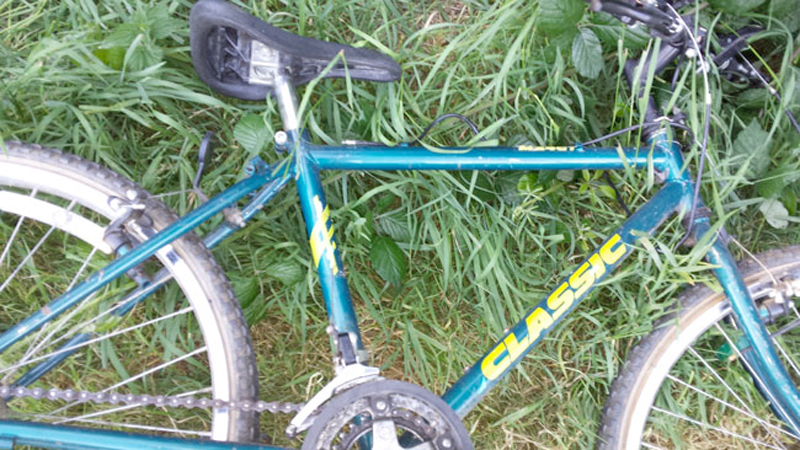
There has been something of a spate of abandoned bikes on the Heath of late and this one was dumped on the Lower Field sometime last night, 1st July. The gear change cable was broken.
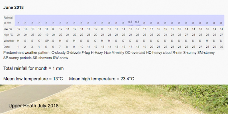
If you have a garden, then you’re probably getting anxious about the lack of rain – well the Heath could do with rain too. Just one look at the grass above tells all. We record rainfall and temperature very close to the Heath and the table above shows that only 1 mm fell during the month of June. There was a similar rainfall of just 1.5 mm in April last year.