No doubt you were wondering what this is. It’s the mud that residents of Fontmell Close and Bridle Close have to cope with to access their homes. A temporary road made of large plastic panels has been installed across the Lower Field to provide access to the houses that are still unreachable due to the sinkhole (geological term ‘crown hole’).
FoBH is collaborating with St Albans District Council (SADC) on a project to reduce underage drinking in Bernards Heath and the associated extreme litter problems that have resulted. The Community Alcohol Partnership (CAP) is an organisation, funded by the major retailers, which brings together all the interested parties including SADC, Police, local retailers,
Trading Standards and the Community to address the problem in a co-ordinated way. They claim to have had very positive results in other parts of the UK and the Bernards Heath CAP will be a pilot for the whole of St Albans.
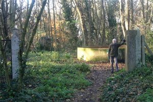
These gateposts are one of the few reminders of the Ariston tallow works on the Heath, a site that has been under consideration for residential development for some time.
In January 2013 Hertfordshire County Council, HCC, announced its decision to sell the former Ariston site, including the Lower Field of Bernards Heath. HCC subsequently decided to offer the site for sale with planning permission in place for residential development and the relocation of existing community uses. Following discussions between HCC and St Albans District Council, SADC, a public exhibition of the planning proposals was held in December 2013 and January 2014.
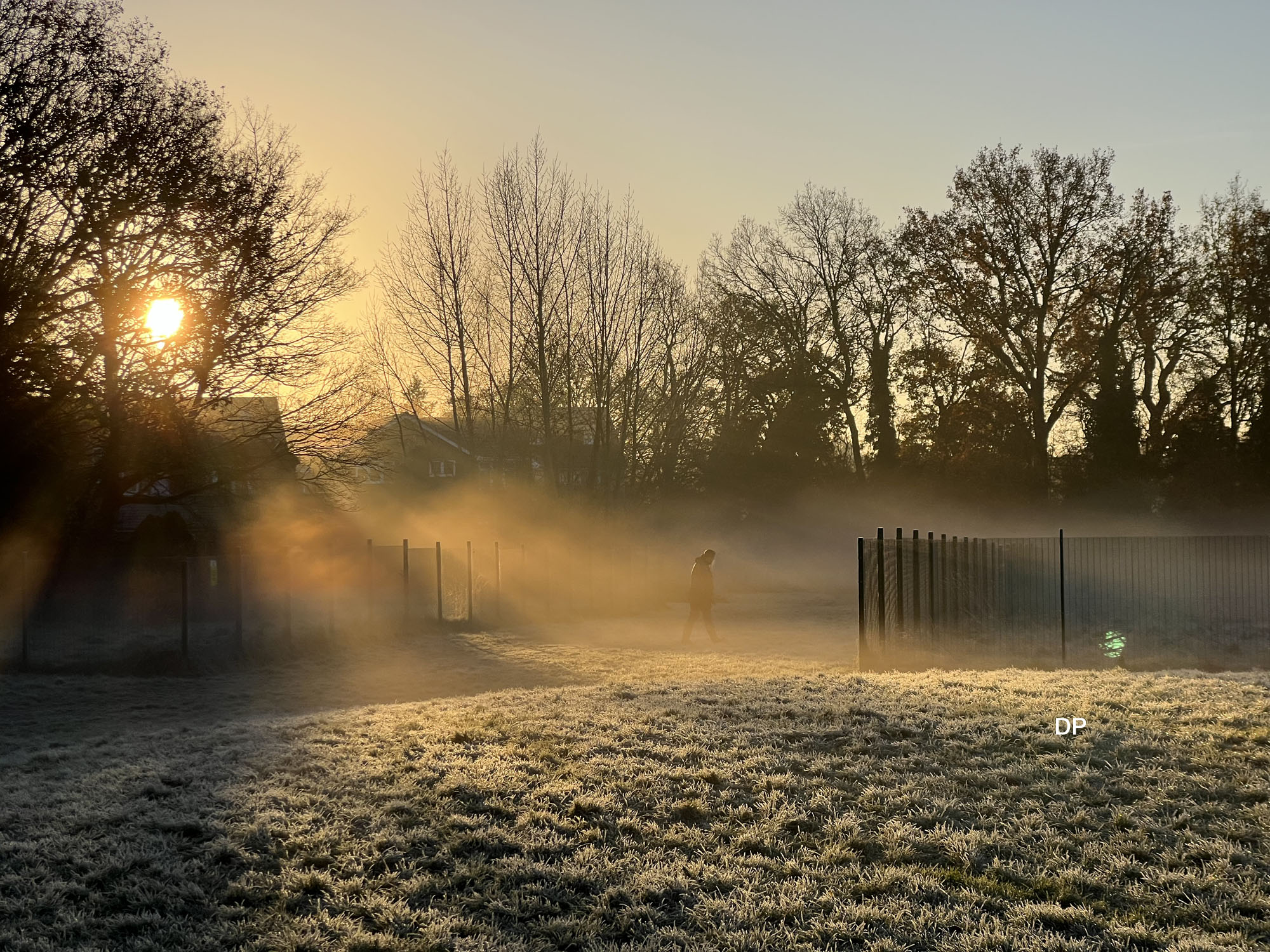
October 20th was one of those few bright sunny days when the trees were their best. This photo shows the the riot of colour that can be seen if you’re lucky.
There are many more autumnal photos of the Heath in our gallery
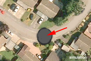
The dramatic impact of a collapse 66 feet across on the residents of Fontmell and Bridle Close is beginning to emerge. Many have suffered loss of essential services and arrangements for emergency services have been made.
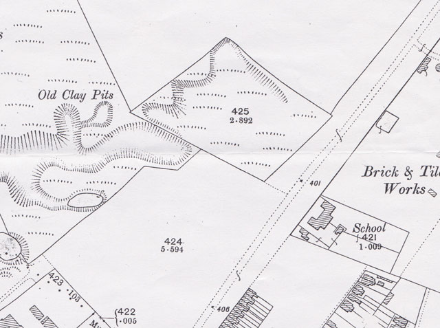
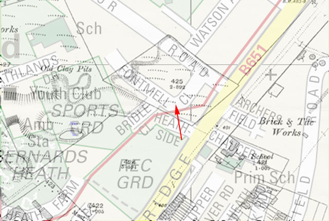
While it has been known for some time that this area of what was Bernards Heath was prone to collapse, the size of hole is unprecedented. An overlay of the 1898 OS map in this area places old clay pits very close to Fontmell Close, see below, and could well be a contributary cause.
1898 OS map showing old clay pitsOverlay of semi transparent 1898 map onto above map. The site is arrowed in red.
Hertfordshire County Council is arranging for some non-intrusive ground investigation works in the area, commencing this weekend (3rd October): they will be on site for about a week. The company concerned is Geotechnology limited, and will be taking access to the site from Heathlands Drive. We await the findings with interest.